
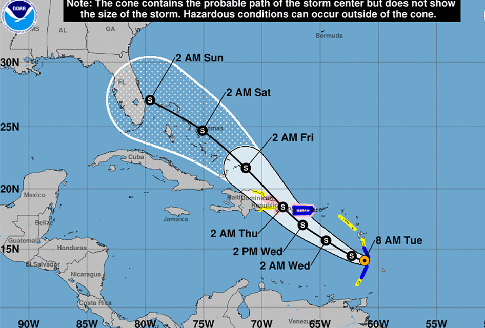
As we’ve been saying, it only takes one hurricane to change a light tropical season to a very active one, and as of today Tropical Storm Dorian continues to gain strength, and the latest track shows Central Florida in its path.
As of 8am Tuesday morning, the fourth tropical storm of the Atlantic hurricane season was 95 miles east southest of St. Lucia and moving west-northwest at 13 mph with maximum sustained winds of 50 mph. The storm is expected to continue on that path until Tuesday night. The National Hurricane Center is predicting that it will make a turn toward the northwest Wednesday.
The most recent cone shows Central Florida in its path with outer bands hitting Florida as early as Saturday. By then, we’re expecting to see maximum sustained winds of 70 mph.
Dorian is expected to gain strength and become a hurricane when it moves near Puerto Rico and eastern Hispaniola Wednesday morning.
The current track shows Dorian becoming a Category 1 hurricane earlier than previously expected, but as it passes over the southern portion of Puerto Rico and Hispaniola, it should lose some of its punch. Hispaniola is a mountainous region that could weaken the storm, but once it reaches open water and moves toward the Bahamas and Florida it is expected to redevelop and possibly strengthen into a category 1 hurricane.


