
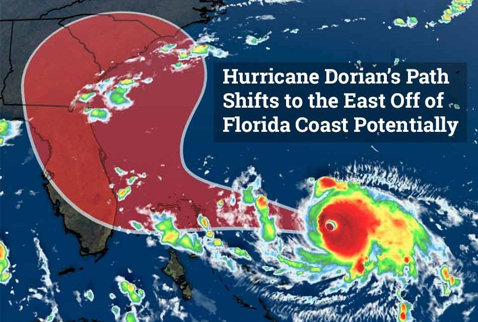
Hurricane Dorian grew into a dangerous Category 4 storm on Friday night with 140 mph winds, but as of the early Saturday morning forecast it shows that the state of Florida may be spared a direct impact.
As of 5 a.m. the projected path by the National Hurricane Center showed the storm pounding the northern Bahamas Sunday and Monday, then turning to the right as it moves northernly, which would keep it off the state of Florida.
Dorian’s slow movement has been filled with change after change as it’s landfall estimations have moved from Melbourne to West Palm to Orlando. Presently, the shift to the right would be the most positive to date for the state of Florida and Osceola County specifically.
We will keep you updated as more changes come.


