
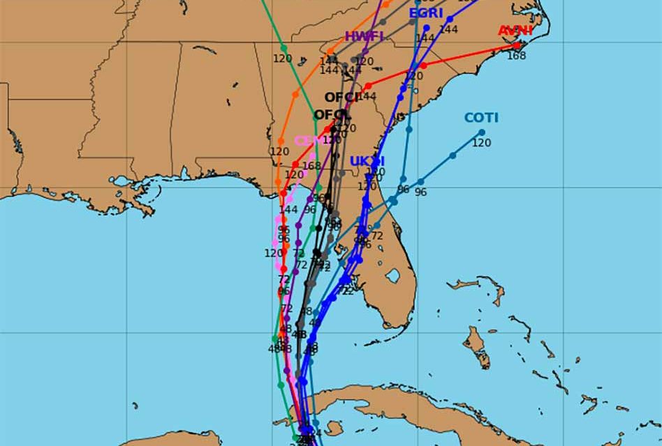
Ian reached hurricane status with Monday’s 5 a.m. advisory packed with winds up to 75 miles per hour. Rapid strengthening is expected on Monday as the hurricane produces significant wind and storm surge impacts in western Cuba on its way to Florida. Central Florida should prepare now for what could be a slow-moving major hurricane that could be a Category 4 before making landfall, possibly near Tampa. Osceola County residents could experience hurricane level wind and rain.
Ian will likely strengthen, possibly quite rapidly and will move northerly on Monday around the edge of the high pressure system. Ian will likely move into the Gulf on Tuesday and move north.
Deep moisture will push north across Florida beginning Tuesday and areas of heavy rain will start moving in. Heavy rain will be possible from Tuesday through at least Thursday with possible flooding.
Winds will increase starting Wednesday. So gusty squalls will be expected Wednesday and Thursday. Tropical storm force winds will be possible. The strength of the winds though will depend on the size, strength and the exact track of the system. Storm surge will be possible starting Wednesday night and Thursday with south to southwest winds. Again the severity will depend on the size, strength and exact track of the system.
Boating conditions will be dangerous from late Tuesday through Friday.
Rotating storms will bring a risk of tornadoes from Tuesday evening through Wednesday.


