
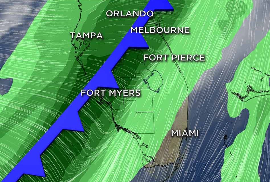
Central Florida, including Osceola County, is at a slight risk — not high, but better than a few percent chance — of severe weather overnight Thursday into Friday morning as a cold front moves through our area. That could make for a potentially dangerous Friday morning commute, and a less than favorable time of getting the kiddos to school on Friday.
Colder air entering into a warmer air mass — high temperatures Wednesday and Thursday are expected in the mid to upper-80s, and warm, moist air and cold air don’t play nicely together — will deliver a squall line of rain that could create 30-40 mph winds with gusts to 60 mph, small hail, lots of lightning, possibly some tornados, and up to an inch of rain.
Those of you with NOAA or weather radios, Thursday night will be a good time to turn it on. Those of you without one, perhaps it’s a good time to get one.
Behind this strong cold front, temperatures will only warm to about 65 Friday. Expect highs in the low 70s Saturday and the upper 70s Sunday, with little rain chance.


