
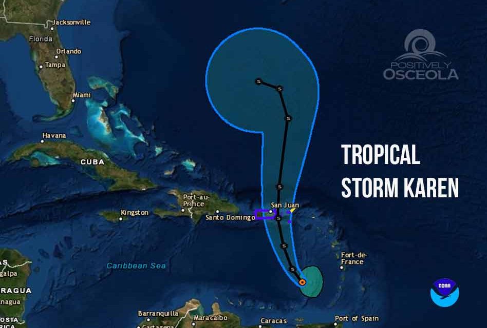

As of the 5 a.m. Monday update from the National Hurricane Center, Tropical Storm Karen currently has sustained winds of 40 mph and is moving northwest at 8 mph toward Puerto Rico and the Virgin Islands.
Tropical storm warnings have been issued for the U.S. Virgin Islands, Puerto Rico, including Vieques and Culebra and a tropical storm watch has been issued for the British Virgin Islands as Karen continues to love farther into the Southern Caribbean Sea.
The storm turned northwest overnight and is projected to shift north by Tuesday targeting Puerto Rico and the Virgin Islands, and then emerge back into the Atlantic by Wednesday.
It’s long-term path, though, has uncertainty with some computer forecast models showing it could become begin heading west toward Florida after five days. The storm’s strength over the next five days is also expected to grow as it feeds off the warm waters north of Puerto Rico, but still east of the Bahamas with projected winds of 70 mph by Saturday.


