
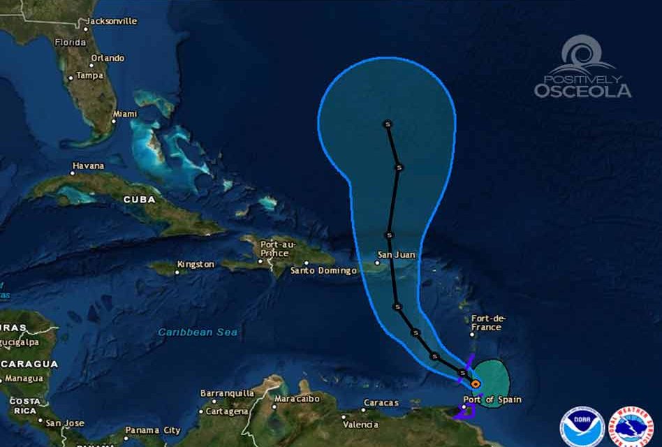
Tropical Storm Karen formed in the Atlantic east of the Windward Islands Sunday morning, and is expected to move northwest and then north toward Puerto Rico over the next several days.
Once hurricane hunters start recon missions and computer models become more aligned, there will be more confidence in where Karen will head after it exits the Caribbean.
The latest NHC model guidance is in very good agreement on Karen moving northwestward around the southwestern periphery of a deep-layer ridge for the next 24-36 hours, followed by a turn toward the north into a break in the ridge currently located over the northern Leeward Islands and Puerto Rico.
In the 72-96 hour period, Karen is forecast to slow down and possibly even stall and turn westward on day 5 as another large ridge moves eastward across the southeastern United States and builds to the north of the cyclone.
Little, if any, change in intensity is expected for the next 48 hours due to strong northeasterly vertical wind shear. However, the upper-level flow is expected to help Karen maintain its current intensity despite the otherwise unfavorable shear conditions.
By 72 hours and beyond, Karen is forecast to move underneath an upper-level anticyclone, which should result in a significant decrease in the shear and also enhance the upper-level outflow, allowing for some strengthening to occur.
A Tropical Storm Watch will likely be required for Puerto Rico and the Virgin Islands later today, and Tropical Storm Warnings may be issued for other areas in the Windward Islands later this morning.
Impacts to Florida are unknown at this time, but we will be keeping an eye on Karen and sharing any updates from the National Hurricane Center.


