
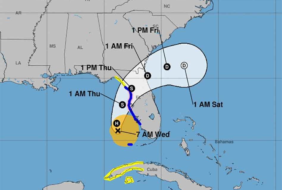
Newly “renamed” Hurricane Eta is continuing to keep meteorologists watching closely as it has strengthened from its tropical storm status to a category one hurricane and is now projected to move east and pass over the state of Florida, likely making landfall near Tampa on Thursday.
Eta has strengthened with maximum sustained winds of 75 mph. Eta sped up Wednesday morning north-northeast at 15 mph after being slow moving earlier Tuesday. It’s tropical-storm-force winds extend outward up to 115 miles from the center. Tropical storm winds are possible for Central Florida, but currently stronger winds will be north of Osceola.
Some areas in Florida may experience heavy downpours that could produce localized flooding.
This would be the storm’s fourth landfall. Eta first made landfall in Central America last week and as a Category 4 hurricane, then in Cuba and in Lower Matecumbe Key late Sunday.
Positively Osceola will continue to bring updates on Hurricane Eta as the National Hurricane Center provides more information.


