
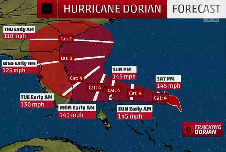
The projected path of Hurricane Dorian by the National Hurricane Center as of its 11 a.m. continues to trend to the east which would potentially lessen the impact to Central Florida. but then taking a sharp right so the center of the storm doesn’t make Florida landfall.
Maximum sustained winds are nearing 150 miles per hour now making it a strong Category 4 hurricane, and although it’s a positive update for Florida, there is still a possibility of life threatening storm surge and dangerous hurricane force winds.
Major Hurricane Dorian is forecast to remain a strong hurricane as it approaches the Florida peninsula. Since the exact forecast still remains uncertain at this time, it is too early to address what impacts will be felt in east central Florida. A Hurricane Watch or Warning will likely be in effect for a portion of the
region early next week.
Ocean conditions will produce a moderate risk of rip currents at all east central Florida beaches today. Swells from Hurricane Dorian will begin to enter the region by late afternoon. Only swim in sight of a lifeguard and do not enter the water alone.
Please continue to be mindful of Hurricane Dorian updates as conditions and projected paths can change at any time.


