
Hurricane Isaias continues to churn on a northwest track as it dumps heavy rains and threatens the Dominican Republic with potentially life-threatening flash flooding and mudslides, Northern Haiti, Turks, Caicos, and the Bahamas.
Those heavy rains may be headed to South Florida as early as late Friday night and East Central Florida on Saturday. Tropical Storm conditions are possible along portions of the east coast of Florida and depending in Isaias current direction, Osceola County will possibly experience some tropical force winds.
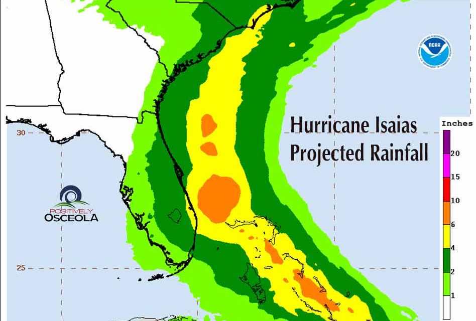
According to the National Hurricane Center, we can expect 2-4 inches of rain. Localized flooding is possible, so take the time now to safely ensure that gutters are clear and sewers in the area are not clogged with debris.
Isaias was officially designated as a Category 1 storm by the National Hurricane Center after midnight, but is projected to reach Category 2 strength Friday night or early Saturday as it continues in its path near Florida.
Isaias is expected maintain a northwestward trek passing over the southeastern Bahamas Friday morning, the central Bahamas Friday evening and east coast of Florida Saturday afternoon.
While the storm’s center is not predicted to make Floridian landfall, Isaias’ hurricane-force winds extend 45 miles from its core, and its tropical-storm-force winds can reach up to 205 miles.


