
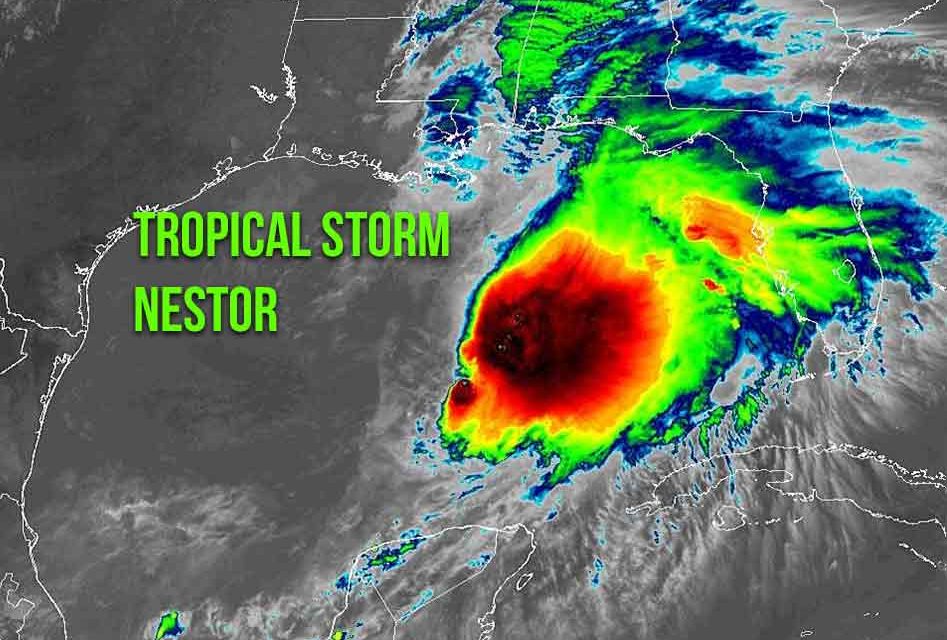
It’s doesn’t change the forecast for Osceola County this weekend — rainy and breezy — but the National Hurricane Center has officially named the storm system in the Gulf of Mexico at Tropical Storm Nestor.
Nestor, with 60 mph maximum sustained winds — up from 40 when it was a “potential cycle” this morning — is still forecast to make landfall Saturday late morning or early afternoon in the Panama City area. Areas in Florida from Tampa north and even east will still get the rain and some wind effects from, as nearly all the storm’s convection is displaced to its east side.
Tropical-storm-force winds extend outward up to 175 miles, mainly to the northeast and east of the center. the NHC said in its 1 p.m. Central time advisory. Nestor is moving toward the northeast near 22 mph (35 km/h), and this general motion is expected to continue through Sunday.
In its wind advisory package from this morning, Orlando was listed as having an 8 percent chance of receiving tropical storm force winds (39 mph and up) through Saturday at 6 p.m.


