
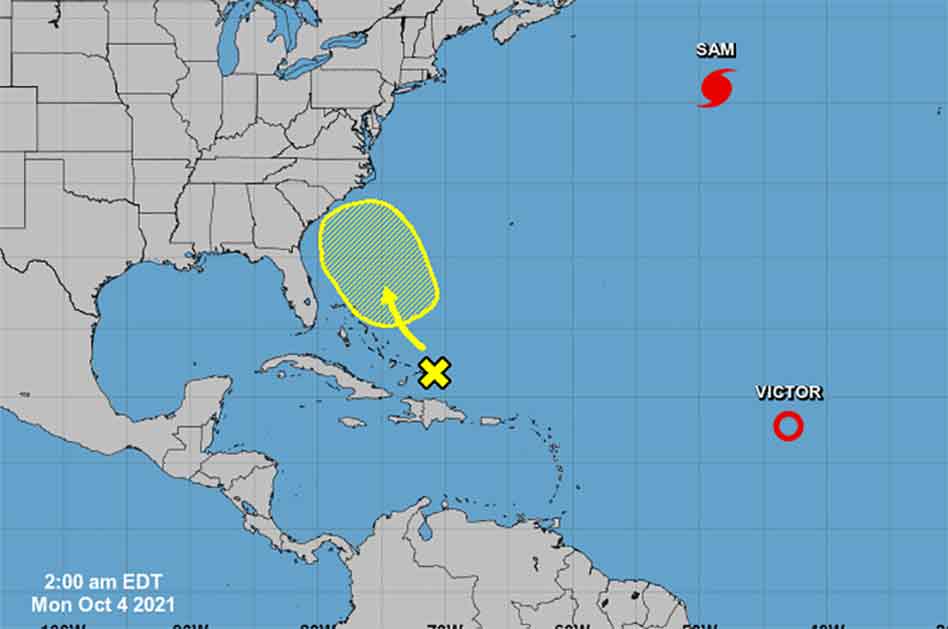
A disorganized area of clouds and showers has developed around southeastern Bahamas and is expected to slowly develop as it moves west-northwestward through Monday followed by a slow northwestward motion through the end of the week.
With the waters off the Florida coast still extremely warm, some development of this system is possible as it makes its way near the southeast coast of the U.S.
The National Hurricane Center gives this area a 20% chance for development over the next five days, but it is too early to tell if rain chances will increase in Central Florida as it looks to skirt the Sunshine state off its east coast.
Positively Osceola will updated this weather story as more information is provided by the National Hurricane Center.


