
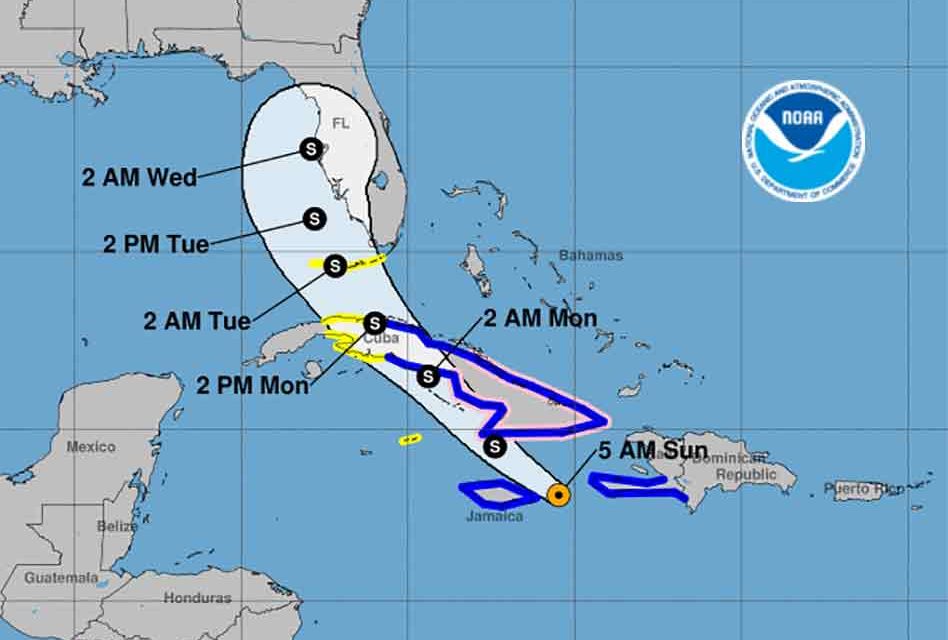
Tropical Storm Elsa’s forward motion has slowed considerably as the storm attempts to get better organized in the Caribbean before engaging Cuba later Sunday. Forecasters predict landfall near Tampa late Tuesday or early Wednesday morning before it darts across the peninsula from west to east.
As of 5 am on Sunday Elsa is 85 miles east of Kingston, Jamaica, and moving west-northwest at 14 mph with maximum sustained winds of 65 mph.
Elsa is expected to move into the Florida Straights Monday bringing tropical storm conditions to the Florida Keys. As Elsa continues to move north to northwest it will potentially make landfall on the Gulf Coast of Florida Tuesday.
Central Florida and specifically Osceola County will likely feel gusty winds, potentially heavy rain, and the potential for tornados as Central Florida is likely to be on Elsa’s dirty side.
By late Tuesday or early Wednesday, the storm is predicted to shift northeast making landfall somewhere near Tampa still with 60 mph sustained winds.
Forecasters say Elsa may weaken slightly while moving across Cuba on Sunday into Monday, before seeing a slight strengthening over the Florida Straits.
If the July 4th holiday has distracted your planning for Tropical Storm Elsa, today is a great day to make sure your hurricane supplies are ready for the hurricane season which already looks like a busy one.


