
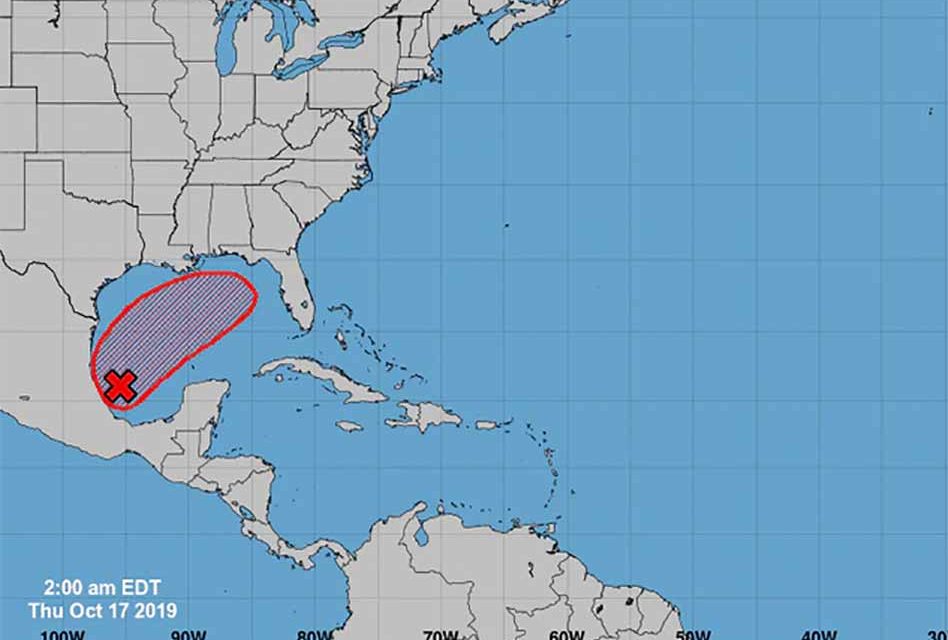
The National Hurricane Center is currently monitoring a tropical system that will possibly move over the state of Florida, the National Hurricane Center said in its 2 a.m. update.
The system over Mexico is has a 70 percent chance of developing into a tropical depression over the next two to five days, and it does become a tropical depression, it could then continue to grow into a tropical storm if it reaches maximum sustained winds of 39 mph. At that time it would the name “Nestor.”
“This system is forecast to move northward and then northeastward across the western and central Gulf of Mexico during the next couple of days and it could become a tropical or subtropical cyclone during that time,” the National Hurricane Center said. “Regardless of development, the low could produce gusty winds and rough surf when it nears the northern Gulf Coast on Friday and Saturday.”
The system’s northeasterly movement currently puts it on a path to pass over northern Florida.
The system is likely to produce gusty winds and heavy showers along the northern Gulf Coast on Friday and Saturday and will likely cause a rainy day on Saturday in Osceola County.


