
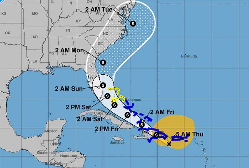
Tropical Storm Isaias, the ninth named storm of the season was born Wednesday night, and continues on a projected path toward Florida. Since the last NHC update, the system’s track has shifted east, which could be a positive thing for Florida, but possibly less favorable for those in the Bahamas.
American computer models show Isaias hugging the east coast and passing by the state as it churns north, while some of the European models show it more on the eastern side of the state.
The disturbance, formerly known as Potential Tropical Cyclone Nine, developed a closed circulation south-southwest of Puerto Rico, Wednesday night, making it possible for the National Hurricane Center to reclassify the system as a tropical storm.
The system is still in a formative state, but eventually, one cluster of thunderstorms may begin to take over in this large storm and could cause a shift to the position, which is why the forecast path is still uncertain.
As of Wednesday night, the National Hurricane Center said the storm was about 155 miles south of Ponce, Puerto Rico, and was moving west-northwest at 20 mph. Isaias was packing 50 mph winds with gusts as high as 52 mph.
A tropical storm warning is in effect for Puerto Rico, the U.S. Virgin Islands and several other countries. A tropical storm watch is in effect for the central Bahamas.


