
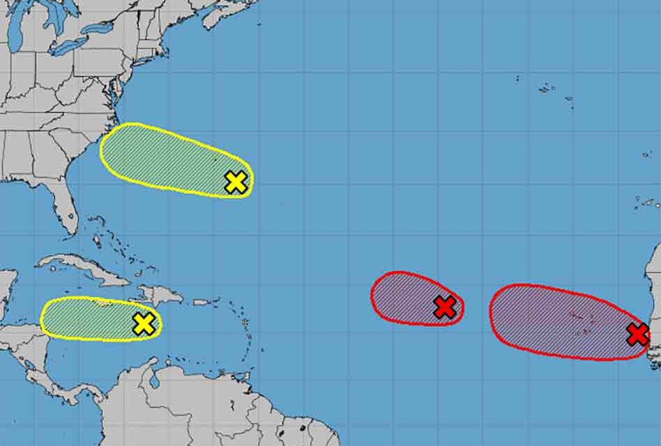
As the Labor Day weekend marches on, so are two tropical waves churning away from Africa, another south of Puerto Rico, and one southeast of Bermuda. None of these are “currently” a threat to Florida. but we’ll be keeping a watch on them as the days progress.
An area of low pressure located about midway between the west coast of Africa and the Leeward Islands is gradually becoming better defined. However, the associated showers and thunderstorms remain disorganized. Gradual development of this system is expected, and a tropical depression is likely to form in the next day or so while it moves westward or west-northwestward across the central tropical Atlantic. Formation chance through 5 days: 90 percent
Showers and thunderstorms are showing signs of organization in association with a tropical wave that is located just off the coast of western Africa. Gradual development of this system is expected, and a tropical depression is likely to form by the middle of the week while it moves generally westward over the far eastern tropical Atlantic. Interests in the Cabo Verde Islands should monitor the progress of this system as gusty winds and locally heavy rainfall is possible there on Monday and Tuesday. Formation chance through 5 days: 80 percent
The third wave located over the central Caribbean Sea continues to produce disorganized showers and thunderstorms. Development, if any, of this system should be slow to occur during the next day or two while it moves westward across the central and western Caribbean Sea. After that time, unfavorable upper-level winds should limit its formation chances. Formation chance through 5 days: 10 percent
A trough of low pressure located a couple of hundred miles southeast of Bermuda is producing disorganized cloudiness and showers. Environmental conditions are only marginally conducive for development during the next several days while this system moves west-northwestward.
Formation chance through 5 days: 20 percent


