
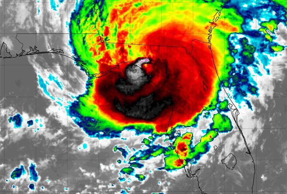
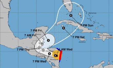
The center of Hurricane Idalia made landfall as a powerful Category 3 storm close to Keaton Beach around 7:45 a.m. on Wednesday, carrying maximum sustained winds of 125 mph with perilous storm surge, destructive winds, heavy rainfall, and flooding. Hurricane Idalia was located about 55 miles northwest of Cedar Key and 65 miles south-southeast of Tallahassee.
The initial assessment is that Idalia equals the most intense hurricane landfall ever documented in Florida’s Big Bend region.
“There will be impacts far beyond the eyewall,” Gov. Ron DeSantis said Wednesday morning at a press conference from the State Emergency Operations Center in Tallahassee.
Many residents in the east and northern portions of Osceola County received an early morning ‘wake-up’ call after the The National Weather Service in Melbourne sent out tornado warnings shortly after 4am. For the most part, Osceola has been receiving some wind, thunder and lightening, and steady rainfall, with minimal reports of damage in connection to Hurricane Idalia.
Before Idalia made landfall it intensifies to a Cat 4 with winds at 130 mph, but according to the NHC, the storm has dropped in intensity from Category 4 as it is going through an eyewall replacement cycle.
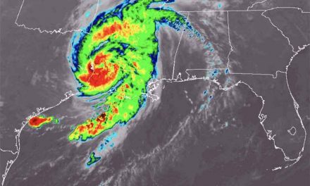
Idalia will now swiftly progress inland, bringing substantial concerns regarding both wind and flooding. Additionally, the risk of tornadoes exists, extending into areas of Georgia, South Carolina, and North Carolina. Consequently, hurricane warnings have been issued for sections of the Atlantic Coast.


