
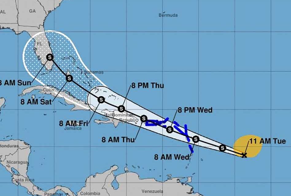
It’s that time of the year when the tropics start to heat up and we start focusing on the possibilities of a storm tracking toward Florida. From the 11am National Hurricane Center’s update, the tropical disturbance in the Atlantic continues to move West and many computer models now show it tracking on a path toward Florida.
For those of us that have a bit of Tropical Storm/Hurricane hunkering down experience, more often than not, when Florida is in the crosshairs this early, the end game for the storm lies elsewhere, or nowhere. Let’s hope that’s the case with the disturbance that someday could go by the name… Isaias – which means “God of my salvation.”
The storm is predicted to churn away and become Tropical Storm Isaias in the next 36 hours or so.
The 11 a.m. advisory includes tropical storm warnings for Puerto Rico, the U.S. Virgin Islands, British Virgin Islands, Antigua, Barbuda, Montserrat, St. Kitts and Nevis, Guadeloupe, Martinique, St. Martin, Saba and St. Eustatius. Those areas could experience tropical storm conditions as early as Wednesday or Thursday.
Currently tropical-storm force winds are extending out 230 miles, mostly to the northeast of its center at about 40m,ph.
Positively Osceola will continue to bring National Hurricane Center updates as they become available. We encourage everyone to inventory your hurricane supplies now, to avoid any possible rush to the stores later, which often happens during the hurricane season.Soon to be


