
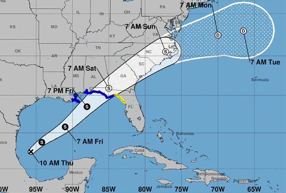
Our weather may turn for the worse this weekend as a potential tropical system has formed in the Gulf of Mexico, and the National Hurricane Center has initiated advisories and issued warnings on Potential Tropical Cyclone for the northeast Gulf coast.
A Tropical Storm Warning is in effect from the Mississippi/Alabama border to the Ochlockonee River, Florida, and from Grand Isle, Louisiana to the Mouth of the Pearl River.
A Tropical Storm Watch is in effect east of the Ochlockonee River to Yankeetown, Florida, and from Indian Pass, Florida, to Clearwater.
At 11 a.m. Thursday the system was located in the southwestern Gulf of Mexico and forecast to move northeast in the direction of the Florida Panhandle. It would be Tropical Depression 16 if the maximum sustained winds reach 35 mph, and Tropical Storm Nestor if it reaches 39 mph. The NHC projects a storm with 50 mph winds making landfall near Apalachicola around midday Saturday.


