
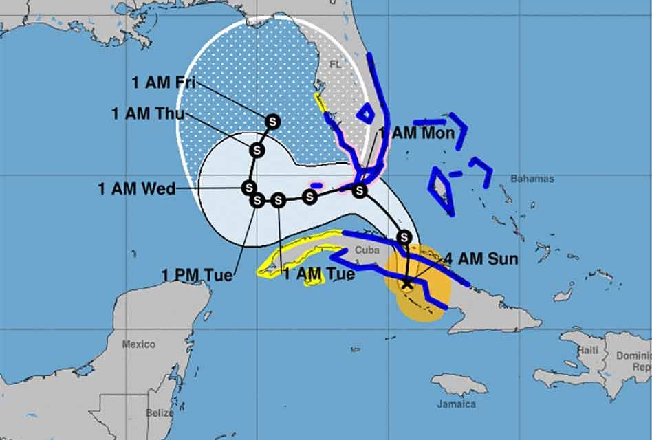
Saturday night, Tropical Storm Eta was about 140 miles west-southwest of Camaguey, Cuba, and is moving northeast at 13 mph.
Maximum sustained winds remain near 65 mph with some higher gusts occurring. Forecasters said some weakening is possible after landfall in Cuba overnight, but the tropical storm is forecast to restrengthen later on Sunday potentially become a hurricane as it approaches Florida.
On the forecast track, the center of Eta will cross central Cuba on Saturday night, approach south Florida and the Florida Keys on Sunday, pass near or over South Florida and the Florida Keys on Sunday night and Monday, and be over the southeastern Gulf of Mexico on Tuesday.
We’re going to continue to keep a watch on Eta as its future track is now showing a potential bend back toward Florida on Thursday and Friday. However, an incoming new weather front could help manage Eta from there.


