
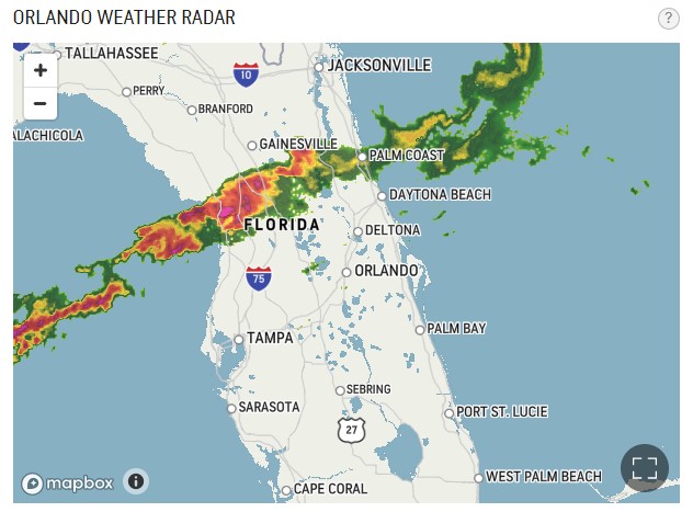
A line of thunderstorms, part of a system that brought tornadoes to the Gulf Coast last night, will move through our area early this afternoon, prompting a severe thunderstorm watch through 3 p.m. and lake wind advisory through 8 p.m. — all in all it’s a good day to heed the stay-at-home declaration if you don’t need to go out.
A line of storms moving onshore to the west coast of Florida this morning is expected to move through Osceola County from about 1 to 3 p.m. Behind the storms, winds out of the southwest from 20-25 mph with gusts to 35 mph are anticipated, creating hazardous conditions on area lakes, and rough waves could overturn small craft.
Due to the cloudy and windy weather today’s high should only reach the low to mid-80s. Highs should be in the high 80s the rest of the week with 30 to 50 percent chances of rain starting Thursday into the weekend.


