
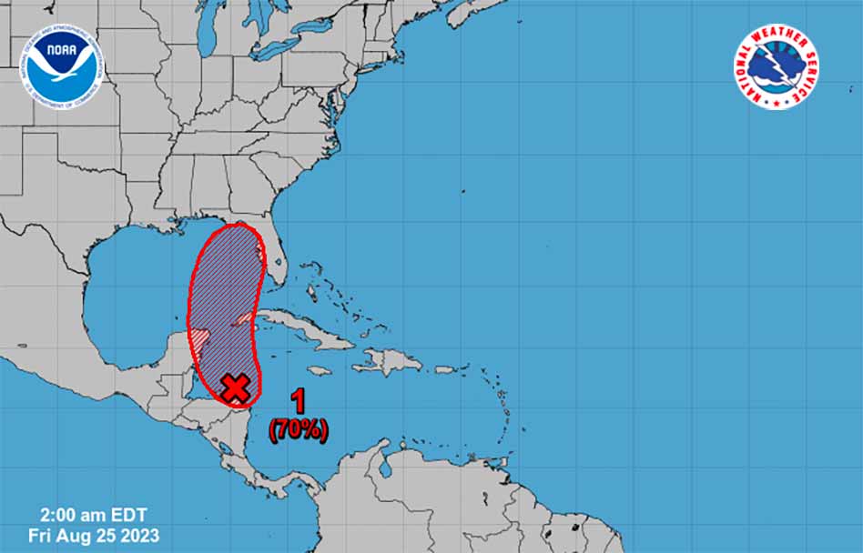
An area of low pressure could strengthen over the northwestern Caribbean Sea in the next couple of days. Some gradual development of this system is possible over the weekend and early next week, potentially growing into a tropical depression or storm that could move slowly northward across the eastern Gulf of Mexico. The disturbance could develop and move east anywhere from Florida’s panhandle to South Florida.
The European weather model shows the storm moving toward the west coast of Florida, possibly near Tampa, while the American weather model doesn’t see the disturbance strengthening into a storm at all. Either way, the disturbance could bring Central Florida and Osceola County showers late Tuesday into Wednesday.
We will continue to bring updates as the National Hurricane Center provides more development information.


